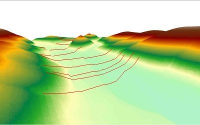
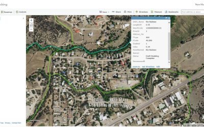
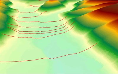
In collaboration with the University of New Mexico’s Earth Data Analysis Center (EDAC) and FEMA Region VI, ESP performed Base Level Engineering for the Rio Hondo watershed, which covers portions of more than 10 counties throughout New Mexico.
As New Mexico’s Cooperating Technical Partner (CTP) with FEMA, EDAC collected high-quality lidar data across the state and engaged ESP to leverage this data by completing over 3,000 stream miles of hydraulic modeling and mapping and incorporated USGS regional regression equations as well as rainfall-runoff methodology for hydrologic analyses.
In addition to model development and mapping, ESP also prepared the final BLE database deliverable complete with CNMS validation and Hazus flood risk assessment as well as provided support at community meetings to present project results.