In response to devastating flooding caused by Hurricane Floyd in 1999, the North Carolina Floodplain Mapping Program (NCFMP) was established to better identify, communicate, and manage flood risks throughout the state. To meet this goal, the Flood Inundation Mapping & Alert Network (FIMAN) was developed to provide emergency managers and the public with detailed, real-time rainfall and stream/flood data, thereby reducing loss of life and property damage related to flood.
Since its inception, FIMAN has evolved from a network of measurement stations (i.e. gages) that collect rain and stream flow information to a sophisticated system of nearly 550 gages and integrated technologies that collect, analyze, map, and communicate flood risk in real-time via a powerful web interface – fiman.nc.gov.
FIMAN Tools
Automated alert notifications
Integrated third-party systems
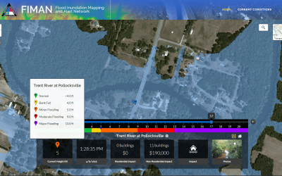
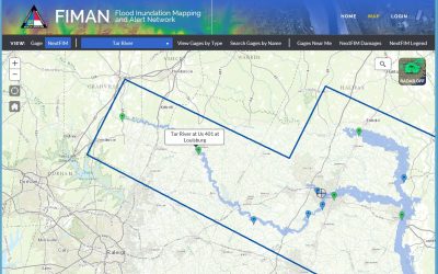
Real-time gage data from stream sensors
Translates real-time data into live stream of GIS features
Processing tools to calculate damage at real-time gage heights
Water elevation slider bar to run what-if scenarios for what would be flooded at higher flood levels