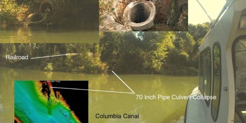
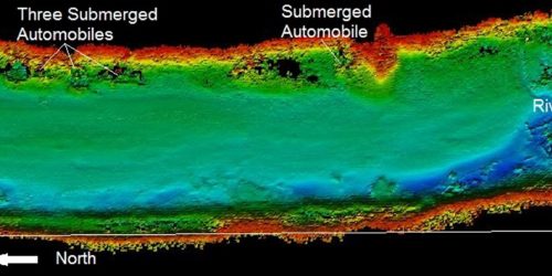
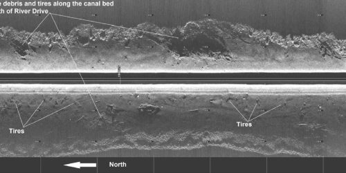
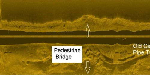
ESP subcontracted with Michael Baker International, engineer for the City of Columbia’s Columbia Canal Embankment Repair project. Our team performed hydrographic surveying services to collect full-bottom bathymetry and sidescan imagery for 2.6 miles of the historic Columbia Canal. The data was used to conduct stability analysis to discern the flood damage associated with the dike breach and flooding that occurred in October 2015.
ESP utilized the services of a portable crane to place Survey Vessel “Eridanus” into the canal for survey operations. Data was collected and processed using HYPACK/HYSWEEP multibeam software. The final digital terrain model was mapped using AutoCAD 2015.